
Water
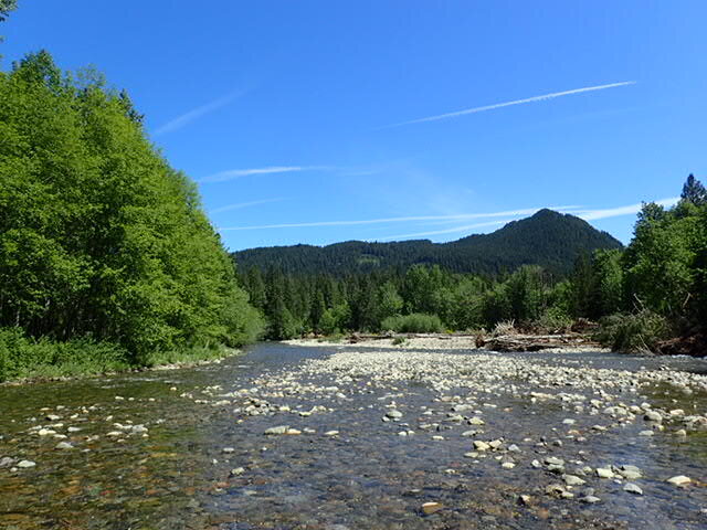
Wind River, Skamania County
There are a number of large river systems within Underwood Conservation District (UCD) boundaries including the Klickitat, White Salmon, Wind and Lewis Rivers. UCD is set in a unique location that spans both sides of the Cascade Mountain Range. Annual rainfall within our district varies significantly, ranging from 99 inches per year on the west end to about 20 inches per year on the east end.
Surface water is water on the surface of the planet such as in a stream, river, lake or wetland. Surface water is replenished by precipitation through overland flow (runoff) and by ground-water. Surface water is lost through evaporation, seepage into the ground, transpiration (by plants) and extraction by humankind for agriculture, living, industry and more.
Groundwater is the water present beneath Earth’s surface in soil pore spaces and in the fractures of rock formations. A unit of rock or an unconsolidated deposit is called an aquifer when it can yield a usable quantity of water. The depth at which soil pore spaces or fractures and voids in rock become completely saturated with water is called the water table.
The Hydrologic Cycle
Rain and snow are key elements in the Earth’s water cycle. Rainfall is the main way that the water in the skies comes down to Earth, where it fills our lakes and rivers and recharges the underground aquifers. Precipitation also falls in the form of snow that accumulates at high altitudes. Snowpack builds up in the winter and melts in the spring and summer. Snowpack is an important water resource that feeds our streams and rivers during the summer months when rainfall levels are low.
Drought
Washington State has experienced drought several times in the past few years. These problems have not been caused by a traditional lack of rainfall drought. Total precipitation can be nearly normal, but unusually warm winter temperatures mean much of the precipitation falls as rain, rather than snow. The lack of snowpack buildup over the winter means that the frozen reservoirs that usually feed rivers and streams during the spring and summer is empty.
Washington State Drought Monitor: http://droughtmonitor.unl.edu/Home/StateDroughtMonitor.aspx?WA
Washington State Snowpack: http://www.nrcs.usda.gov/wps/portal/nrcs/detail/wa/snow/products/?cid=stelprdb1248202

Water Conservation
Water conservation, using water efficiently and avoiding waste, is essential to ensure that we have adequate water today and into the future. Water conservation is especially important during a drought. UCD can help district residents think about ways to save water around the home and farm. Project ideas include planting native and drought tolerant plants, converting to more efficient forms of irrigation or improving your soils moisture holding capacity.
Water Quality
Water quality refers to the chemical, physical or biological characteristics of water. Water quality is an important consideration for a variety of uses including human consumption, fish, recreation and more. Underwood Conservation District periodically collects, bacteria, temperature, dissolved oxygen and flow data from surface waters in our district. UCD works with district landowners to implement best management practices that protect and enhance water quality including livestock exclusion fencing, off-stream watering, riparian buffer planting, irrigation efficiency upgrades and more. Water quality issues are exacerbated by drought conditions due to the effects of decreased dilution in low flow conditions. Consider the concentration difference between a drop of contaminant in a five gallon bucket vs. a drop of contaminant in a one gallon bucket.
Washington State Water Quality Map: https://fortress.wa.gov/ecy/waterqualityatlas/map.aspx
Although UCD is a non-regulatory organization, there are important regulations that surround water resources. To help landowners navigate who to call, and when, we have put together the following document: Questions About Water Resources?